Mangroves, saltmarsh

Introduction

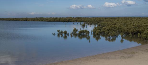
Mangroves and saltmarshes play a critical role in supporting the health of the bays by providing important ecosystem services including filtration, roosting habitats for shorebirds (including the rare orange-bellied parrot), fish nurseries and helping reduce coastal erosion.

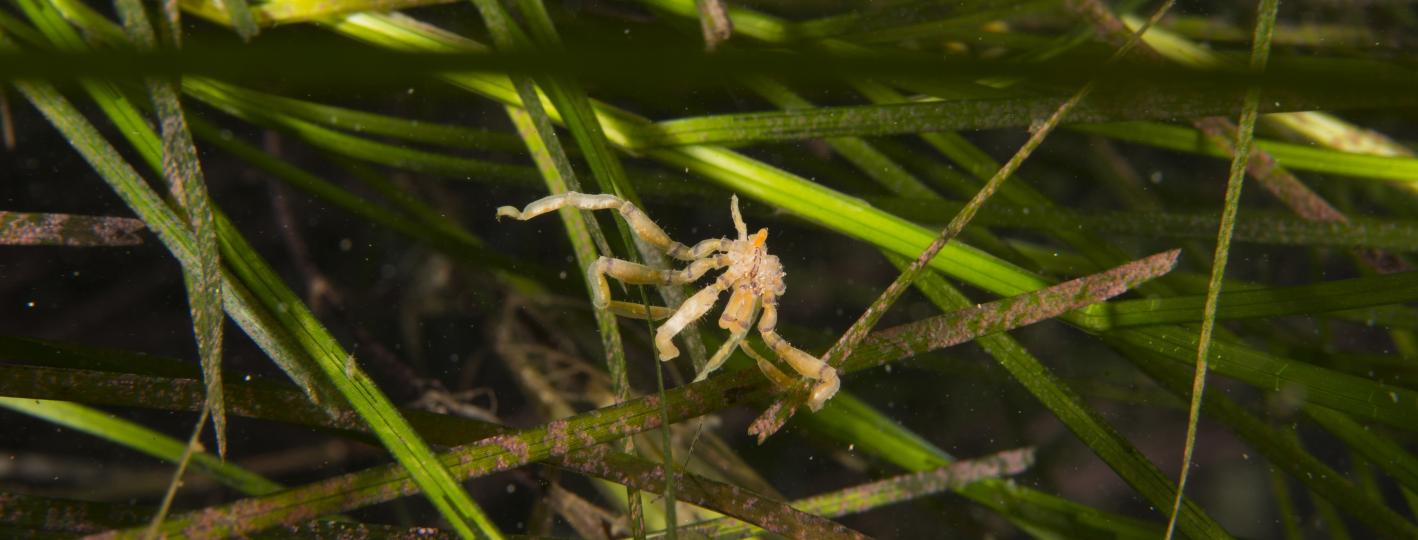
Seagrass and rocky reefs are also important intertidal habitats in the bays, and are considered in the Seagrass and the Reefs topics respectively.

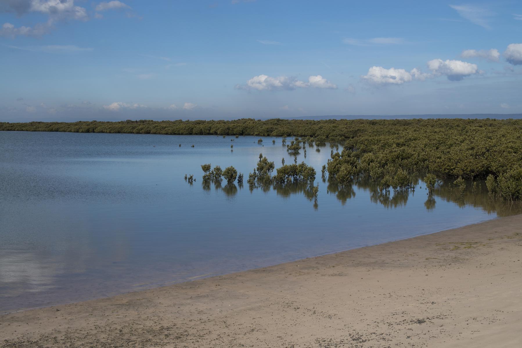
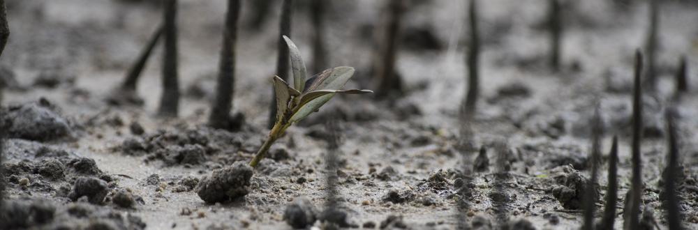
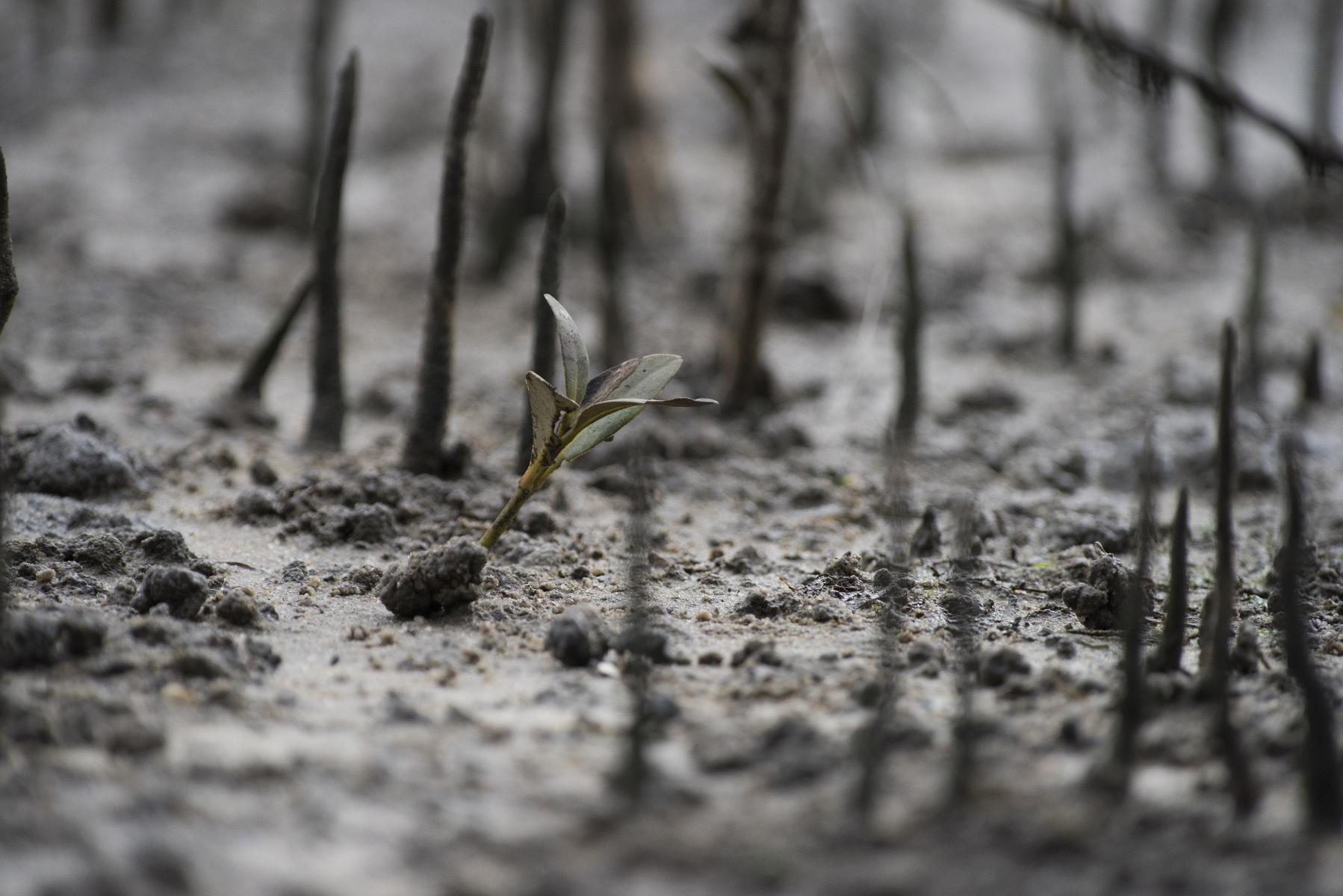
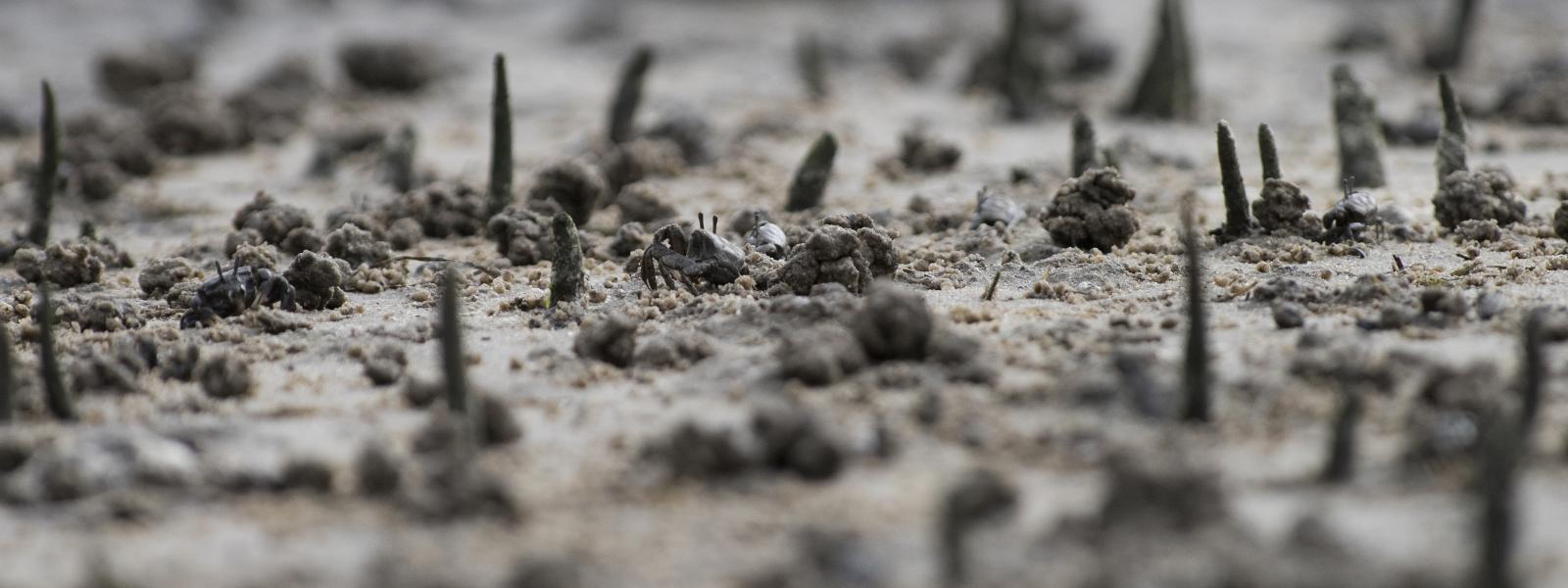
Mangroves are salt-tolerant trees that grow in the intertidal region of sheltered embayments and estuaries. Only one species, Avicennia marina, occurs in Victoria. Mangroves helps to prevent erosion, helps to filter the water and improves its quality and the plants sequester carbon.

Saltmarsh tends to occupy the area between the mangrove zone and the upper tidal limit, and is inundated during the spring tidal cycles. Port Phillip Bay and Western Port support a diverse saltmarsh flora, particularly herbs and low shrubs such as samphire, rushes and grasses to name a few. 

Where mangrove and saltmarshes are located and thrive is determined by:

  • coastal land and shoreline topography
  • geology
  • tidal cycles, and
  • dynamic processes including sedimentation and water run-off.

There are a number of factors threatening these intertidal habitats in Port Phillip Bay and Western Port:

  • Sea level rise is affecting mangrove encroachment (shading out saltmarsh), expanding saltmarsh pools in the north of Western Port (which fragment saltmarsh), and affecting sedimentation patterns.
  • The invasive pest Spartina (cordgrass) impact on the extent and healthy ecology of intertidal habitat.
  • Elevated nutrients and changes to sediment impact on the vegetation and associated ecosystems.
Fact

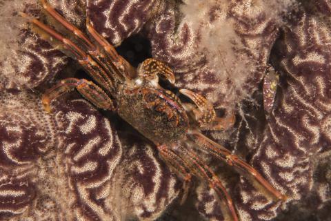
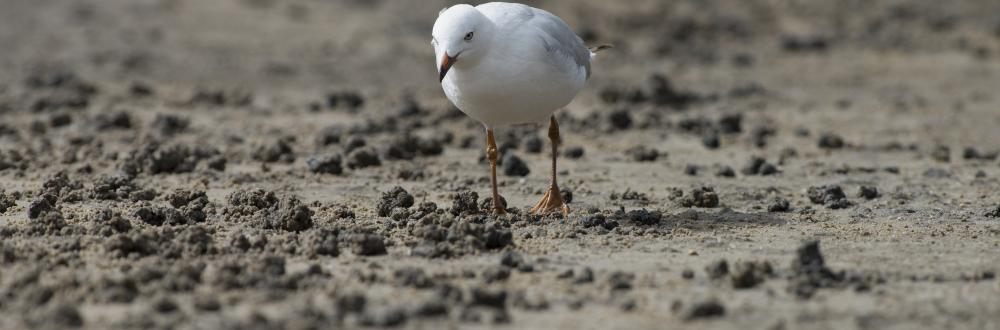
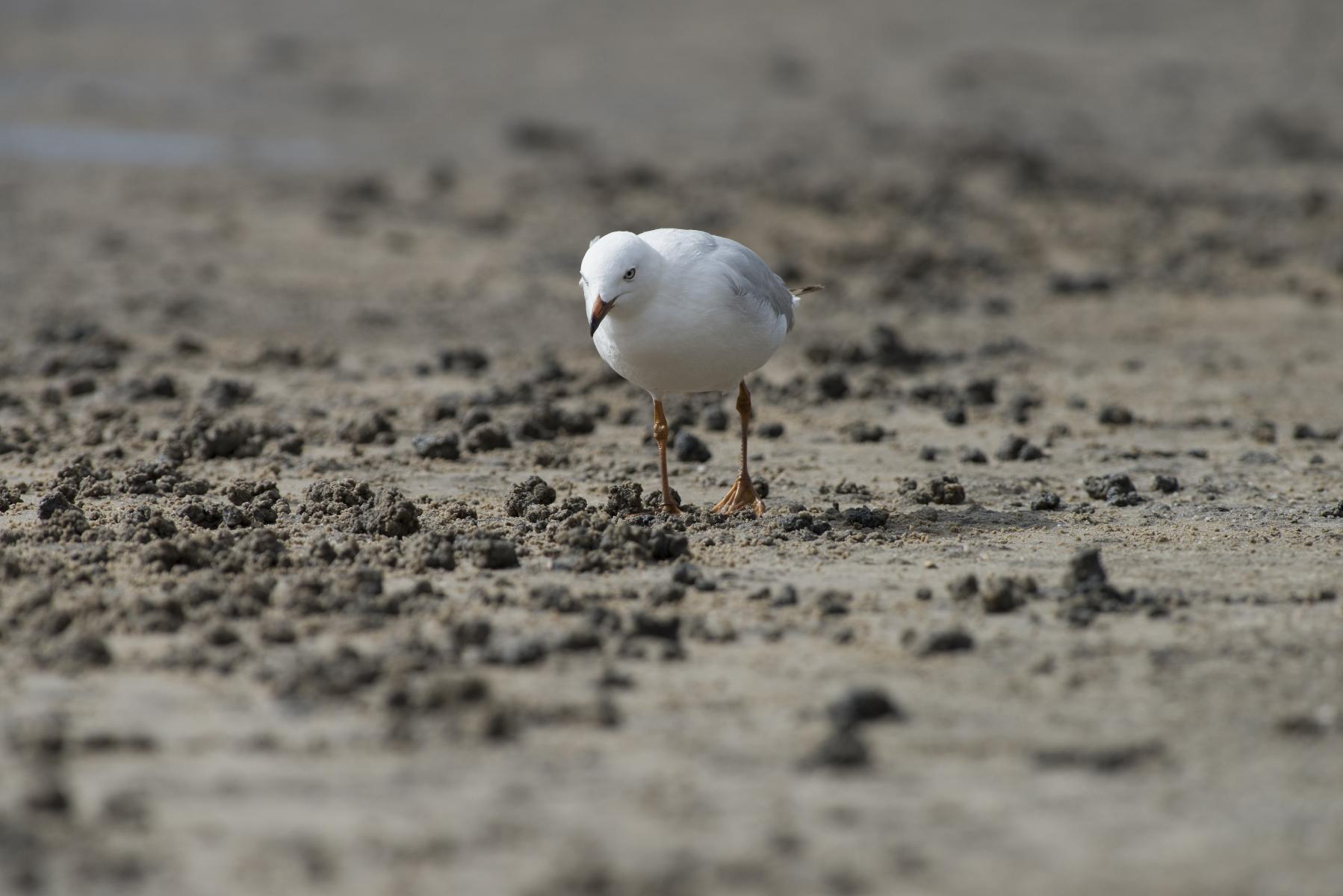
An estimated 30–40 species of birds inhabit the intertidal habitats of Port Phillip Bay and Western Port. These species are distributed across the habitats – some are attracted to the exposed soft sediments, others to the fresh water inputs or the open saltmarsh (like the endangered orange-bellied parrot), and others to the ponding water, both fresh and salt. Some shorebirds have salt glands and can actually drink salt water.

Citizen science

What happens in our estuaries has a direct impact on what happens in the bays. Contribute to the critical task of monitoring and data gathering by joining EstuaryWatch.

Estuaries are semi-enclosed bodies of water where saltwater from the sea mixes with freshwater flowing from the land. Observations, photos and water quality data collected by ‘Watchers’ are used to alert and inform marine managers of algal bloom, fish death and storm surge responses and are incorporated into estuary management plans and research projects. You can get together with like-minded volunteers once a month to conduct a variety of citizen science tasks to ensure water quality in your local area.

Port Phillip Bay

Mangroves are not a major component of intertidal vegetation in Port Phillip Bay when compared to Western Port. It is predicted that the amount of mangroves surrounding Port Phillip Bay hasn’t significantly changed, however, the results of a 2011 survey show that saltmarsh habitats are now reduced to around 50% of the historic saltmarsh area present at the time of European settlement.

In 2011, a bay-wide monitoring program assessed  the extent and health of saltmarsh and intertidal mudflats at:

  • Jawbone Marine Reserve
  • The Spit Conservation and Nature Reserve
  • Swan Bay
  • Mud Islands.

Saltmarshes and mudflats were monitored annually from 2008 to 2010. Scientists measured saltmarsh boundaries, the makeup of species, the cover and condition of the saltmarsh, and conducted surveys of shape and size of mudflats.

What we know

The results of the 2011 bay-wide monitoring program showed:

  • No increase in exotic species.
  • No significant change in species composition.
  • A decline in the health of shrubby glasswort at Jawbone and The Spit in 2011, that may be linked to the ponding of freshwater at these sites following heavy rains in late 2010 and early 2011.
  • A notable decline in the health of shrubby glasswort at Mud Islands in 2010, due to the establishment of an ibis rookery, which killed over 80% of the plants.

What we don’t know

Increased rainfall in 2010 and 2011 led to lower areas of the saltmarsh becoming covered in pools of water and extensive algal growth, particularly at the Jawbone site. The increased rainfall also reduced salinity throughout the bay; indeed salinity in the bay was less than that in Bass Strait in December 2010 for the first time since 2006. This increased inundation and lower salinity may have affected the health of saltmarsh plants, but further study is required.

ReefWatch divers are the underwater watchdogs of Port Phillip Bay, so not much happens without them noticing. In fact ‘ReefWatchers’ were the first to sight the introduced nudibranch (Thecacera pennigera) as well as the range extension of the very hairy nudibranch (Bursatella leachii).

Western Port

In Western Port the mangrove habitats are much more extensive than in Port Phillip Bay. It is estimated that Western Port still has approximately 90-95% of its mangrove and saltmarsh extent that was present at the time of European settlement.

Saltmarshes in Western Port are in a fair condition but are healthy compared with other areas around south-east Australia. The saltmarshes are diverse and healthy, but there are threats to their resilience. These include the impacts of urban growth and rising sea levels.

To understand the effect of human development on saltmarsh, the Department of Environment, Land, Water and Planning (DELWP) has been collecting data on extent, mangrove-saltmarsh vegetation structure, and changes in rates of sedimentation and surface elevation since 2000. DELWP found land-use activities caused increased sedimentation and freshwater run-off. These effects in turn helped mangroves to further encroach on saltmarsh communities.

Sedimentation and sediment accretion

Sediment build-up in the mangroves and saltmarshes of Rhyll, Koo Wee Rup, Quaill Island and French Island is relatively high.

Aside from the saltmarsh at French Island, elevation gain is low in other mangroves and negligible in saltmarshes, and lagging well behind the regional sea level trend.

Those saltmarsh sites not gaining elevation as sea levels rise are more likely to be colonised by mangrove. This result is the prevailing situation across south east Australia, including Western Port. It's facilitated by local factors, including drought-related subsidence, and local alterations to drainage.

Fact

Seagrass, mangroves and saltmarsh bury carbon at a rate 35–57 times faster than tropical rainforests and can store carbon for thousands of years. Recent global data estimate vegetated coastal habitats contribute 50% of carbon burial in the oceans – a function called ‘blue carbon’.

Climate change

Continued sea level rise is the most concern and will lead to:

  • further invasion of saltmarsh by mangrove
  • dieback of fringing myrtle at the seaward edge of the terrestrial zone
  • dieback of saltmarsh leading to the expansion of saltmarsh pools. 

What we know

Urban development and human impacts are putting mangroves and saltmarshes under threat from trampling, domestic animals and the building of new infrastructure too close to the intertidal habitats.

Saltmarsh survival

The survival of saltmarsh in areas of urban development will be negatively impacted by hard surfaces, like roads and concrete paths being built too close to the saltmarshes. When the sea level rises, mangroves will encroach upon saltmarsh habitat. Saltmarshes will be prevented from growing away from the shore. Saltmarsh will be stuck between the mangroves and urban infrastructure.

Triggers for erosion

  • type and makeup of sediment
  • how the coastline sits relative to the dominant wind-wave directions and the direction of longest fetch (the length of water over which wind has blown)
  • frequent inundation through the tidal cycle, and
  • seasonal wind patterns with winds predominantly from the west.
Seagrass encroachment
Seagrass encroachment. Credit - Greg Harbour, Matter

What we need to know

Understand the impacts of sea level rise

It's important to understand the ways tidal overflow affects waterlogging and levels of salinity in saltmarshes – including invasion by mangrove, and the expansion of saltmarsh pools (the best early indicator of saltmarsh fragmentation).

It's important to continue to monitor the link between rising sea levels and mangrove encroachment on the bay's saltmarshes. Mangroves are resilient to gradual sea level rise – benefitting from the increased nutrients and sediments; but rapid sea level rise would have a bad impact on mangroves, killing communities and probably causing seagrass beds to expand into what were previously mangrove habitats.

Understand patterns of erosion

Erosion is an immediate problem for saltmarsh on the eastern shoreline of Western Port, where recent change is evident. Often, more erosion occurs in saltmarsh communities when mangroves are not present. Mangroves can help saltmarsh, by preventing erosion; but mangroves also compete with saltmarsh for sunlight and can harmfully shade the saltmarsh.

Erosion is complex and different erosion types have different effects. As sea levels rise and impact key ecosystems, more understanding is required of the role of:

  • elevation
  • erosion
  • sediment provenance (the original source of sediments being deposited)
  • sedimentation rates, and
  • the impacts of storm surges in intertidal habitats in the bays.

Understanding other threats to saltmarshes

Another important subject for further study is to understand the strength and weakness of saltmarshes to other threats such as:

  • nutrient enrichment
  • oil pollution
  • weed invasion (such as Spartina)
  • altered salinity, and
  • changes in the flow, level and volume of water coming into the bay (the hydrological regime).
Fact

Despite the significance of the intertidal mudflats, most of the research on soft sediments in Western Port is 35-45 years old, and requires updating.

Are our mangroves and saltmarshes healthy?

Despite their proximity to Victoria’s largest cities, Melbourne and Geelong, Port Phillip Bay and Western Port are quite healthy overall.

To measure the environmental health of the bays, the Commissioner for Environmental Sustainability worked with marine scientists who identified 36 indicators across the six key topics you see on this website.

The indicators were chosen because they best ‘indicate’ whether that key topic is healthy.

Here's how mangroves and saltmarshes measured up:

Port Phillip Bay   Western Port  
Saltmarsh condition good Saltmarsh condition fair
Saltmarsh and mangrove extent good Saltmarsh extent fair
Foraging shorebirds fair Mangrove condition good